The history of the Vakhiyo valley from 2000 BCE to the 11th century
The origin of the name “Vakhiyo”
Before setting out into the history of Vakhiyo, it is worth starting with the very name of this ancient mountain valley. Vakhiyo is a name that has been kept by the people of these mountains for many generations. But where did it come from, and what did it originally mean?
There is no exact answer to this question today. At the same time, folk memory has preserved several legends and versions, each of which tries in its own way to explain the origin of this ancient name.
One legend tells of three brothers — Vokh, Khloz and Tur — who came to this valley in distant times. The exact time of their arrival is unknown, and today one can only assume that it happened roughly one and a half to three thousand years ago. According to this legend they also had a fourth brother, who went to the Rasht valley, where he later died without leaving descendants. The memory of the three brothers remained tied to this land. One tradition links the origin of the name Vakhiyo precisely with the name of the eldest of them, Vokh — it is assumed that over time Vokh turned into Vakhiyo.
However, there is another legend that suggests a completely different origin for the name. It links Vakhiyo with the name of Hazrati Burkhi Sarmasti Vali and claims that the land may originally have been called Burkhiyo, and that over time the name changed and came to sound like Vakhiyo. This version is especially interesting because the name of Hazrati Burkh holds a special place in the spiritual memory of the people of Vakhiyo and is linked to the ancient history of the valley.
But the versions do not end there. According to another suggestion, the name Vakhiyo may be connected with the ancient name Vakhshur. The name of the Vakhsh river is sometimes linked to the same ancient root, which suggests an older geographical tradition from which both names may have come.
There is one more version that goes deep into the ancient Iranian linguistic heritage. Some link the name Vakhiyo with the Avestan word “vahya”, which is rendered with meanings related to good, kind or best. If this version is correct, the name may originally have described the land itself — as blessed or special.
So we find different paths leading to one name: Vokh, Burkhiyo, Vakhshur and Vahya. Each version reflects a separate layer of memory about this land — folk legend, spiritual tradition, ancient geography or linguistic heritage.
But which of them is the original one?
Today we cannot say this with complete certainty. The origin of the name Vakhiyo remains an open question, and its true story may be hidden much deeper — in ancient languages, forgotten names and the legends of people who lived here long before us.
And that is why our story begins with this very riddle.
What was the land that received the name Vakhiyo?
To come closer to an answer, we now have to leave the origin of the word itself and look at the land it names — its mountains, rivers, valleys and ancient natural world.
The genetic history of the valley
While religious tradition links the ancient history of Vakhiyo above all with the name of Hazrati Burkhi Sarmasti Vali, the scientific and historical version looks at the past of this land through a longer process — ancient cultures, migrations, mixing of populations and genetic ties.
One important point must be kept in mind: the history of Vakhiyo itself in deep antiquity is still far from fully known. We know about the cultures and states that existed in Central Asia and in the lands neighbouring Vakhiyo, but there is still not enough direct written or archaeological evidence to establish exactly what population lived in the valley itself and which state directly controlled it in each particular period.
The Bronze Age and BMAC
One of the oldest cultural complexes of Central Asia is the Bactria–Margiana Archaeological Complex, BMAC. It took shape in deep antiquity, roughly in the 3rd–2nd millennia BCE, on the territory of Central Asia.
Within our historical version it can be assumed that people associated with BMAC may have spread much more widely than the archaeological centres known today and may have lived in different parts of Central Asia, including the mountain areas and possibly the Vakhiyo valley.
One important piece of evidence for the antiquity of the lands neighbouring Vakhiyo may be the ancient town of Karon in the neighbouring region of Darvoz. According to available information, it may be about 5,000 years old.
If this dating is correct, the existence of such an ancient centre in neighbouring Darvoz shows that the mountain lands around Vakhiyo were already part of an area with ancient settlements and developing human societies in deep antiquity.
But who exactly lived in Vakhiyo itself at that time, and whether there was a separate settlement or political entity here, is still unknown.
The Sintashta and Andronovo migrations
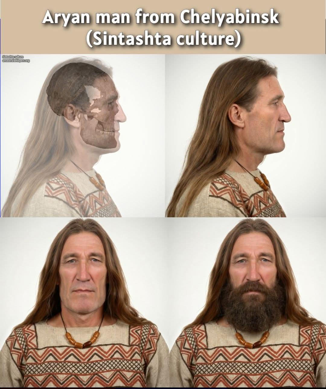
The next important stage is linked to the migrations of ancient steppe groups and the spread of the Sintashta and Andronovo cultures.
According to our hypothesis, people of these cultures and the ancient Aryan groups associated with them may have gradually moved south and reached various parts of Central Asia. The territory of Vakhiyo may have been one of the possible directions of their movement.
If such a migration really took place, the incoming groups may have met the existing local population, which in this model is associated with BMAC.
As a result, the two components may have mixed — the local BMAC one and the incoming Aryan one.
But it must be stressed: this is only a theory. There is as yet no direct archaeological proof that bearers of the Sintashta or Andronovo cultures migrated specifically to Vakhiyo.
The Yaz culture and the genetic hypothesis
A special place in this version belongs to the Yaz culture, which we regard as one of the possible results of the interaction between the ancient local BMAC component and the Aryan population.
According to the model we use, the first representatives of the Yaz culture had roughly 60% Aryan and 40% BMAC ancestry.
This is where an interesting link with the present-day population of Vakhiyo appears.
In the DNA tests we carried out on people from Vakhiyo, we found that some members of the Vakhiyo population are significantly close to people associated with the Yaz culture.
Individual people from Vakhiyo showed up to 90% correspondence with the Yaz culture.
Among the people we regard as having best preserved the original, relatively unmixed Vakhiyo component, the average results were about 52% Aryan and 35% BMAC ancestry.
These figures are quite close to the model we associate with the population of the Yaz culture.
According to our interpretation, to preserve such a level of the ancient Aryan component the population must have remained relatively isolated from large-scale mixing with other groups for a long time — presumably about 1,500 years or more.
However, according to this model, the history of the Vakhiyo population did not stop at the BMAC and Aryan mixture.
The Saka and South Asian component
In later periods new genetic components may have entered the population of Vakhiyo.
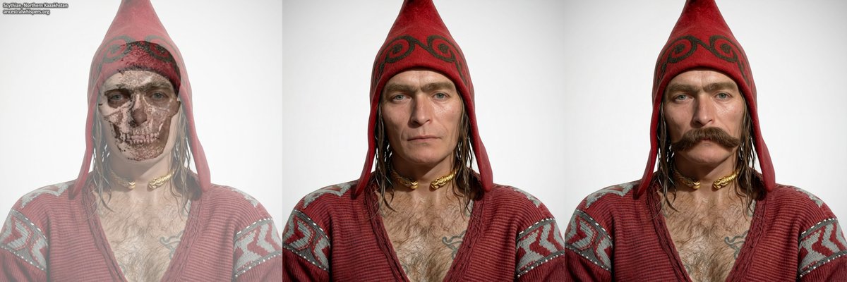
One of them may have been a component associated with the Saka. According to our hypothesis, it was Saka groups that may have brought a certain East Asian component into the population of Vakhiyo.
In addition, some South Asian component is assumed, which may have come to Vakhiyo from the Hindu Kush area.
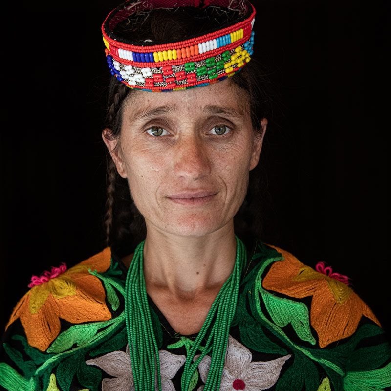
Thus, within this model, the present-day population of Vakhiyo was formed not by a single migration but by several historical layers — the ancient local population, a possible BMAC component, a later Aryan component, and then later contacts and mixing with the Saka and the population of the southern Hindu Kush.
According to our interpretation of the DNA results, on average the population of Vakhiyo may have about 70–80% genetic correspondence to the Yaz model, while about 20–30% falls to a component associated with later Saka admixture.
These results are part of our genetic hypothesis about the formation of the Vakhiyo population and require further study
General information about the Vakhiyo valley
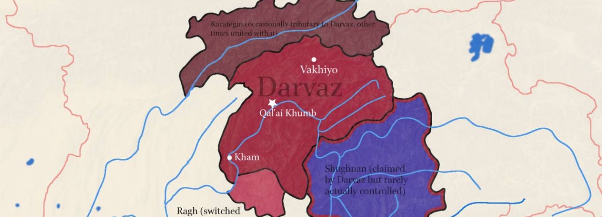
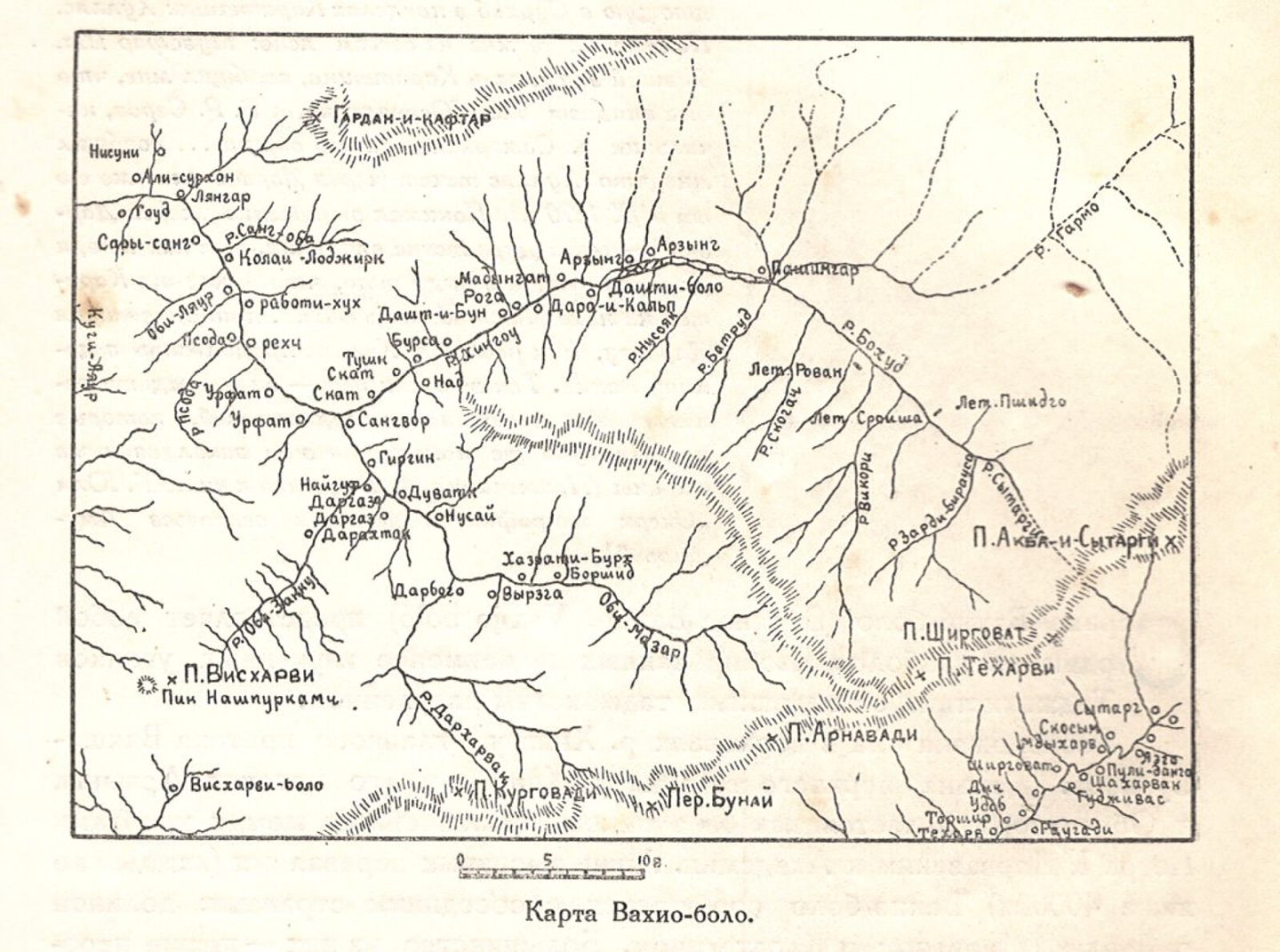
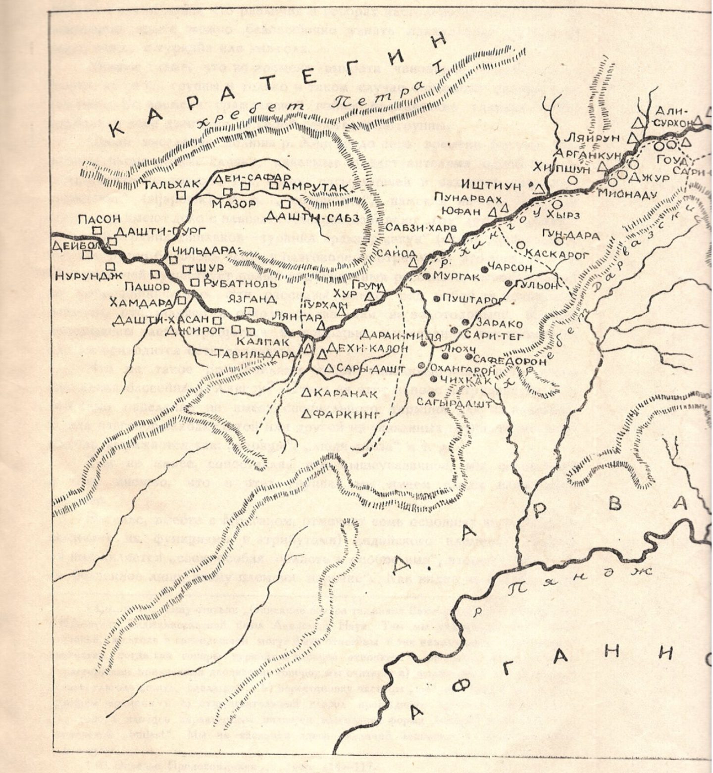
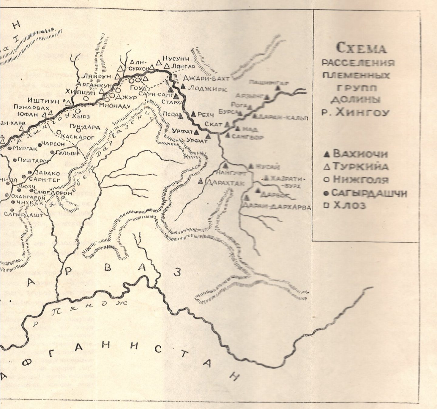
The Vakhiyo valley is a picturesque corner of our homeland. It lies in the basin of the Khingob river and its tributaries, the Obi Arzing and the Obi Mazor, which rise from the Gando, Garmo and Fedchenko glaciers between the Peter the First and Darvaz ranges. The valley stretches from west to east for 250 km.
Most people in the Khingob basin call themselves Vakhiyochi. The Vakhiyo valley in turn is divided into two parts: Upper Vakhiyo (from Jari Bakht up to the end of the valley) and Lower Vakhiyo (from Jari Bakht downwards).
The valley begins at Sari Char, 150 km from the Dushanbe–Khorog highway, and runs along the Khingob river. The Peter the First range lies to the right and the Darvaz range to the left. From the village of Sangvor, below which the Khingob is formed by two tributaries — the Obi Arzing and the Obi Mazor — the valley continues further.
Along the Obi Arzing, the Peter the First range runs on the right, and along the Obi Mazor, the Academy of Sciences range. A number of other mountain massifs and heights belong to the Peter the First and Darvaz ranges. The highest peak is Ismoili Somoni Peak, 7,495 m high.
The Peter the First range separates the Vakhiyo and Rasht valleys, and the Darvaz range separates the Vakhiyo valley from Darvaz and Vanj.
More than 25,000 people live in the Khingob basin. Outside the Vakhiyo valley, in other regions such as Tajikabad, Lakhsh, Vanj, Shughnon, Panj, Kurgan, Jilikul, Shahrituz, Kubodiyon and others, more than 400,000 Vakhiyochi live.
Administratively, the valley belongs to several districts: part of the Nurabad district, the Sagirdasht jamoat of the Darvaz district, the Sangvor district, and the Ismoili Somoni and Garmo peaks in the Academy of Sciences range, which are in the Murgab district.
The population is engaged in farming and gardening: they grow apples, walnuts, grapes and other crops; grain — wheat, barley, pulses, millet and flax; vegetables — potatoes, tomatoes and others; and also keep livestock, bees and work in forestry.
Medicinal plants grow in the Vakhiyo valley: zira, choykahak, tkharch, zelol, khuch, chukri, toron, rov, kamol, mehrigiyokh, hazorispand, kimiyokahak and others.
The Khingob basin has numerous minerals and various underground resources; among them are coal deposits at Darai Khayron–Miyonadu and Alisurkhon, salt deposits in Miyonadu, iron and some non-ferrous metals, in particular gold, silver and others.
The wildlife of the valley includes various wild animals — the wolf, bear, fox, mountain sheep, hare, mountain goat, some species of wild cats, venomous and non-venomous snakes. Birds include the partridge, vulture, eagle, sparrow, myna, swallow, crow and others. Various kinds of fish live in the Khingob and its tributaries, such as gulmohi, shirmohi and others.
Depending on the season there is a lot of snow and rain here. From November, and sometimes from December, until March the plains, slopes and mountains are covered with snow.
The name Upper Vakhiyo refers to the territory above Jari Bakht, and Lower Vakhiyo to the territory below Jari Bakht.
The Vakhiyo valley consists of five small regions, or in other words, tribal territories:
Vokh — the territory of Upper Vakhiyo from Jari Bakht upwards.
Khloz — the territory from Sari Char to the village of Yozgand, including the corresponding part of the bank. This area includes the villages of Kaftarguzar, Yofuch and Yonur, which administratively belong to the Nurabad district.
Turkiya — the territory from the village of Yozgand upwards, including the surroundings of the Tavildara village council, up to Jari Bakht.
Nizhgoliya — in the past covered the village of Miyonadu and its surroundings. As local people say, they exchanged goods and property with their neighbours, that is, they were each other's partners, which is how the area got its name. If you look at the geographical position of this area, you can see that Miyonadu and its surroundings connect the two parts of the valley. It is no accident that the area is called Miyonadu and is considered one of the largest areas of Vakhiyo.
Sagirdasht lies on the left bank of the Khingob. Today this area includes the Sagirdasht village council and the surrounding villages. The word “Sagirdasht” means a small plain. At present the territory administratively belongs to the Darvaz district, but historically and geographically it is part of the Vakhiyo valley.
A historical journey through the valley
From the information obtained it becomes clear that the Vakhiyo valley has an ancient, rich and varied history.
The oldest historical object found in this valley is a bronze axe. It was found in June 1932 by workers of the Tojikzoloto gold-mining company near the village of Sangvor. In 1933 A. Alter, head of the Tavildara district mining administration, handed the axe over to the museum of the Institute of Anthropology and Ethnography of the USSR Academy of Sciences. The axe (number 5124/1) is still kept there.
The axe is wedge-shaped, 10.6 cm long and 4.3 cm wide. The shaft hole is very large (3.3–3.5 cm in diameter) and almost round. The height of the Sangvor axe from the blade is 7.2 cm, and to the butt 3.7 cm. According to scholars, the axe is a weapon. The well-known archaeologist B. Litvinsky believes that it dates to the Bronze Age — the end of the 3rd millennium and the first quarter of the 2nd millennium BCE.
A similar axe was found by Narzullo Roziqov in the autumn of 1957 during fieldwork in the village of Arakchin in the Varzob district.
In 1982 archaeologists continued their survey in the Khingob basin and discovered and described historical monuments. Of particular importance among them are “Qalai Sher-1”, “Qalai Sher-2” and “Qalai Lokharv” (local pronunciation Lulikharvi, A. Sh.). Since these monuments have not yet been studied sufficiently, the exact time of their construction is still unknown. According to archaeologists of our country, they date to the beginning of the Middle Ages.
“Qalai Sher-1” lies north of the village of Miyonadu, on a hill on the left bank of the Khingob. The hill has the shape of an irregular triangle; its south-eastern side is 150 m, the south-western 150 m and the northern 85 m. A defensive wall in the form of a wide stone rampart has survived on the eastern, southern and western sides. On the northern side of the fortress there is a deep ravine and a steep cliff, so there is no defensive wall there. The walls had egg-shaped towers.
On the top of “Qalai Sher-1” remains of buildings can be seen in the form of small mounds. There are fragments of clay pottery; it has not been possible to establish when it was made.
“Qalai Sher-2” lies about 200 m west of “Qalai Sher-1”, on the same ledge of the hill.
This fortress is round; it measures 60 m from west to east and 30 m from south to north, and it is 5 m high. The fortress was fortified. Defensive structures in the form of a stone rampart have survived. There is no defensive wall on the northern side, as that part was protected by a steep ravine. Numerous fragments of khums (large storage jars) and other vessels can be seen on the top of the fortress.
“Qalai Lokharv” (Chiniyob — A. Sh.). On the left side of the road between the villages of Ishtiyon and Miyonadu are the remains of a fortress standing on the high part of the right bank of the Khingob. The fortress is an irregular quadrangle. Its western side is 110 m and its southern side 70 m; on the south and south-west it is protected by a steep cliff. On the northern, eastern and western sides remains of fortifications with towers have survived, which now look like a high rampart. The fortress was very strong and blocked the road along the Khingob. Its surface is covered with many pottery fragments whose date cannot be determined.
The well-known scholar N. A. Kislyakov, in his work “Essays on the History of Karategin”, drawing on Russian scholars' research on the ancient inhabitants of this region, notes that in very ancient times descendants of the Saka lived here. Citing V. V. Bartold and V. Minorsky, N. A. Kislyakov confirms this view.
We have learned about the ancient population of this region from the studies of Russian researchers. Manuscript and other data suggest that the Kumeds — the ancient inhabitants of this valley — were descendants of the ancient Saka and the indigenous population of the area. To support this idea, V. Minorsky refers to Ptolemy, according to whom the inhabitants of the land of Kumed consisted of the Saka tribe of the Kumeds.
The correctness of this view was confirmed by the well-known Tajik scholar, Academician Bobojon Gafurov. The book “The Tajiks” says of the population of Central Asia in prehistoric times: “In the 7th–6th centuries BCE the whole of Central Asia was inhabited by Iranian peoples — Bactrians, Khorezmians, Sogdians, Saka groups and others. On the basis of these peoples, above all the Bactrians and Sogdians, the Tajik people took shape in the early Middle Ages.”
Kumed (Kumeto) is mentioned in Chinese sources as Jumito (Kiu-mi-to). V. V. Bartold notes that Ibn Rusta called Kumed “Kumiz”, and al-Yaqubi “Kumod”.
Scholars also disagree about the geographical location of Kumed. Some looked for it in the Rasht valley, others in the upper reaches of the Kofarnihon and Surkhon rivers, and still others in the present-day districts of Darvaz and the western part of Badakhshan.
V. V. Bartold objected to the view that Kumed lay in the Rasht valley. At the beginning of the 20th century, in his work “Turkestan Down to the Mongol Invasion”, Bartold mentions Kumed alongside Rasht and other regions under the name “Karategin”. This is, of course, the Kumed of the Muslim geographers and the Jumito of the Chinese travellers. Muslim authors placed this region on the Vakhsh river below Karategin; it may have included Darvaz and the northern part of Badakhshan. According to the Chinese, the road from Khuttal (the region between the Panj and the Vakhsh) to Shughnan passed through Kumed.
One of the Buddhist pilgrims, Xuanzang, who travelled to Central Asia in 630, found Tokharistan under Turkic rule. He notes that as a result of the struggle between the rulers of Tokharistan the state had split into 27 small states and in the end became subject to the Turks. Xuanzang names a number of domains of Tokharistan — Chighoniyon, Ho-lu-mo, Shumon, Khutalo and Ku-mi-to. Researchers have tried to match these names with certain areas of present-day Tajikistan.
A deep analysis of the sources, and especially of the Chinese pilgrims' journeys, is given in the works of the Soviet scholar L. A. Borovkova. By comparing the accounts of Chinese travellers with those of Arab travellers and the modern place names of Tajikistan, she put forward interesting and convincing ideas.
From this the author concludes that in antiquity certain regions of Central Asia played an important role on well-known routes. L. A. Borovkova writes: “The information obtained allows us to confine Jumito to the valley of the Obi Khingob river. In the ‘Xin Tang shu’ this river is called Heihe (the Black River). More precisely, this state lay on the territory of the Tavildara district, from where the only caravan route led to the Western Pamirs and on to Khorog. There were Shini (Shitsini and Khumi) Damositedi. The Fochuhe river, that is, the Panj, does indeed flow south of Tavildara, but it is a long way off. Therefore the existing view that Jumito was in Darvaz (and not Tsyuemichzhi) is confirmed by our calculations.”
The view that the ancient state of Kumed (Jumito in its Chinese form) was located in the Darvaz area was supported by the scholar A. M. Mandelshtam.
Historical sources from the Samanid period mention the names of the emirs of Chaghaniyan (Saghaniyan), Abu Bakr Muhammad ibn Muzaffar and his son Abu Ali Ahmad ibn Muhammad, who were rulers of Khorasan.
Citing Minorsky's information on the continued rule of the emirs of Chaghaniyan, V. V. Bartold writes about them on the basis of the well-known work “Hudud al-Alam”: “Abu Ali, the emir of Chaghaniyan, asked the emir of Khatlon for help and gathered an army… [after which a battle took place]”. Elsewhere Bartold notes that after the fall of the Samanid dynasty the emirs of Chaghaniyan kept their power.
The Russian scholar N. A. Kislyakov lived and worked in the Vakhiyo valley in the 1930s, studying the history, social and economic conditions, customs and traditions of its people. He published several works and articles. About the first inhabitants of this region he cites the following legend: “Legends confirm that the first settlers from Yakhsu were four brothers, one of whom went to Karategin. The remaining three settled in the Khingob basin. Their names were Khloz, Turk and Vokh. The first settled in the village of Rezak near Childara, in the lower reaches of the Khingob; the second in Tavildara, in the middle part; the third in Upper Vakhiyo. These three legendary figures became the founders of the three main groups of the population of the Khingob basin — Khloz, Turkiya and Vakhiyo…
The grave of Khoja Khloz is in the village of the same name near Childara.
The grave of Vokh is probably in Upper Vakhiyo, since there is a view that the name Burkh is a distorted form of “Vokh”. Khoja Khloz and Vokh may have had a totemic past, since the first appeared in the form of a tiger and the second in the form of a nakhchir (wild goat).
The well-known historian B. A. Litvinsky, drawing on the research of the European linguist C. Bartholomae and American scholars, highlights the ancient names of the tribes of Central Asia: “The ancient names of the Central Asian nomadic tribes occur in written sources; in the Avesta these names are used for the enemies of the settled Iranians, including the Turas (tura), who in Yasht XII, 55–56 are called ‘the Turas with swift horses’. This name occurs in one of the oldest parts of the Avesta, the Gathas, in connection with the activity of Zarathustra, where friendly relations with descendants of the Turas are mentioned (Yasna 46, 12). If we accept that Zarathustra lived in the first half of the 6th century, we can accept that already then some of the Tura tribes had close ties with the settled farming population.”
From this it can be concluded that the names Tur and Turkiya for some localities and villages, including remote mountain areas, do not mean that the ancestors of these people were Turks or Turkic-speaking tribes. It is quite possible that the Tura tribes were the same Saka tribes, that is, remnants of the Aryans.
Thus, even if only briefly, we have become acquainted with the ancient history of this valley. An analysis of the sources and of scholars' research on the past of this region shows that information about Kumed can be traced up to the beginning of the 11th century. After the fall of the Samanid state and the rise to power of nomadic Turkic tribes, and then the Mongols and the Uzbek khans, a large part of mountain Tajikistan found itself isolated for a long time.
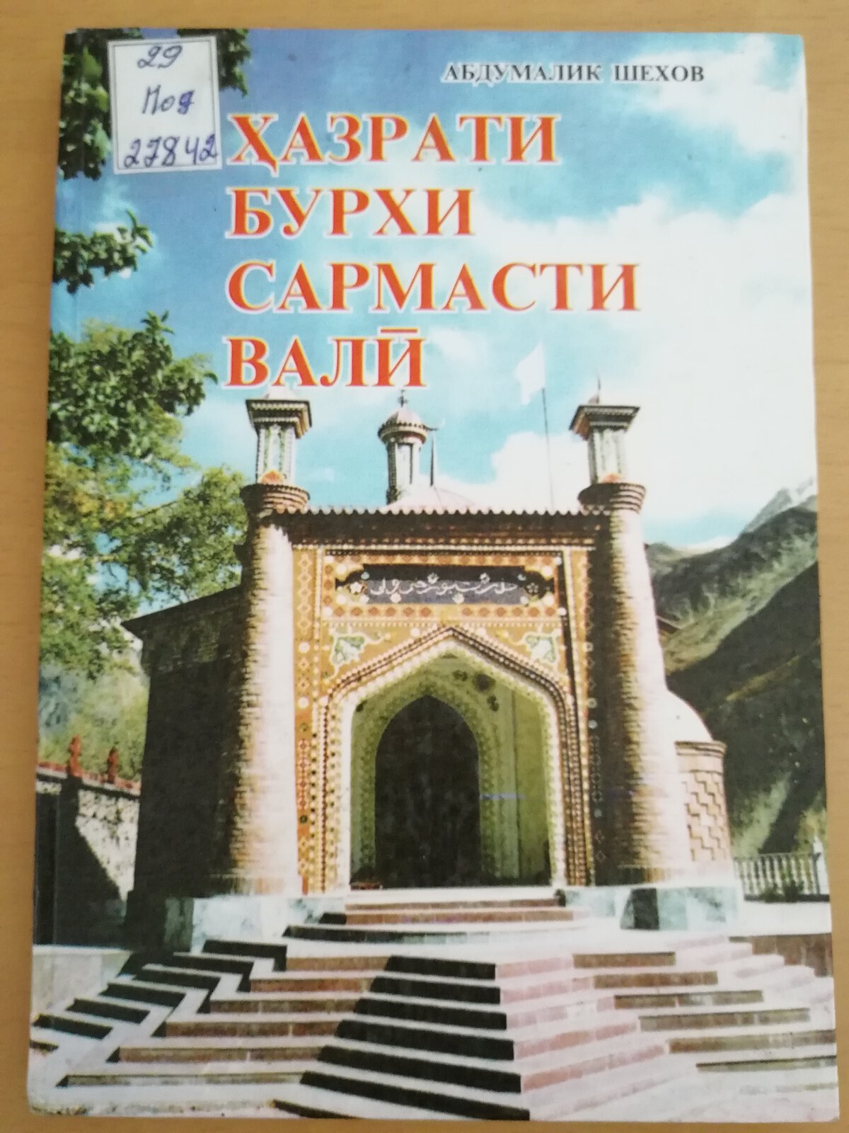
It should be noted that among the people of the Khingob basin there is a legend according to which the name Vakhiyo is a distorted form of the name Burkh, that is, in the distant past this area was called Burkhyo. Thanks to the great Hazrati Burkhi Sarmasti Vali, whose shrine stands in the upper part of this region, the ancient name of the valley has survived to this day.
In this book the author set himself the task of gathering detailed information about the past of this region, including Vakhiyo, and of considering its whole history. It is very difficult to accomplish this within a small book. On the other hand, it must be admitted that written and other materials on the history of various regions of Tajikistan still survive and need to be studied seriously.
Only with enough opportunity for deeper research will we be able to study the unknown pages of this region's history.
Hazrati Burkhi Sarmasti Vali
Information about the great saint
We gathered information about the parents and close relatives of the great saint from a manuscript we received in 1997 from Nemat Abdulloev, a resident of the village of Naiguf in the Tavildara district. In the early 1980s this manuscript was handed over by Mullah Umar, a former resident of the village of Borshid who lived in the Bokhtar district, to Sunnat Abdulloev and Nazar Aliev.
After this document was examined by scholars of the Institute of Oriental Studies and Written Heritage of the Academy of Sciences of the Republic of Tajikistan, including the well-known scholar Amriyazdan Alimardonov, it became known that at the end of the 19th century the manuscript had been copied from an older manuscript in a fast nastaliq hand.
The manuscript has 63 pages. It contains information about the father and mother, brothers and sisters of the great saint and about his coming to the mountains. It also contains several stories about Hazrati Burkh. Pages 58–61 mention the names of 36 mutavallis — guardians of the great saint's shrine.
It is known that a similar manuscript was already known in the 1930s. N. A. Kislyakov noted that the manuscript mentions 36 mutavallis. By his calculations, each of them served for about 25–30 years, so that by this count the history of the building of and service at the mausoleum of Hazrati Burkhi Sarmasti Vali spans more than 1,000 years.
N. A. Kislyakov set out the conclusions of his research on the figure of Hazrati Burkh and the history of his shrine in the article “Burkh — the mountain goat”, published in 1934 in the journal “Sovetskaya Etnografiya”.
After analysing the information about Hazrati Burkh, N. A. Kislyakov notes that the legends and stories about this great man repeatedly mention the nakhchir: at Burkh's command a nakhchir gives itself up to the builders of the mausoleum to be sacrificed; a spring appears where the nakhchir's blood was spilled; the spring water is considered miraculous and the land is called “Burkh's land”; the saint's grave is covered with a mat woven from goat hair, and so on.
Taking all this into account, N. A. Kislyakov concludes that the image of Burkhi Vali arose from a gradual change in ideas about the nakhchir — a totem and first ancestor — after which the idea of a holy spirit, Khoja Buz, appeared. Islam turned the ancient deity into a saint. In the author's view, this is the essence of Kislyakov's conclusion.
It should be noted that this point of view was supported by other researchers too. At the same time, V. N. Basilov in the early 1970s rejected the view that the shrines of Hazrati Burkh and Khoja Khloz had a totemic past. He stressed that the presence of animals in legends about saints is traditional and is not proof of the totemic character of a shrine.
There is a legend about Khoja Takka Burd, who, according to the story, led the nakhchir to the saint's dwelling place.
The second argument that V. N. Basilov gives against the totemic character of Hazrati Burkh and his shrine is linked to the activity of craftsmen. Such a connection is also typical of other saints. For example, in Khorezm Bahauddin Vali, who lived in the 14th century, was considered the patron of pottery.
V. N. Basilov notes that the people of Vakhiyo have kept many legends about the revival of the veneration of Hazrati Burkh. In particular, the legends say that Burkh came to this area as a traveller and made it his home. “Thus,” notes V. N. Basilov, “the veneration of Burkh in the upper reaches of the Obi Mazor does not confirm the assumption that the image of the saint arose from the disappearance and gradual transformation of the totemic beliefs of the local population. The mention of these animals in legends about some Muslim saints cannot be a reason to assume that the veneration of these saints is linked to a totemic veneration of nakhchirs and sheep.”
The manuscript found in the village of Naiguf tells us that Hazrati Burkhi Sarmasti Vali was born in the time of Hazrat Musa (Moses), in the family of Hazrati Hoshim Jabali, one of the grandsons of the prophet Shis (Seth). His mother was Bibi Jalila of Arafat. He had three brothers: Hazrati Turki Abdol, Barki Abdol and a younger brother whose name is not mentioned. They lived in Arafat. His father, Hazrati Hoshim Jabali, died in Arafat.
The manuscript says that the brothers suffered great oppression from their fellow tribesmen. So Hazrati Burkhi Sarmasti Vali and his brothers came to their mother, told her what had happened and asked her to leave Arafat with them. For this reason the family of Hazrati Burkhi Sarmasti Vali left their homeland.
From Arafat they went to Rum, and from Rum to Kabul. One of his brothers died in Kabul. From Kabul they went to Taliqan, where the youngest brother died. After burying his brother, Hazrati Burkhi Sarmasti Vali went with his mother to the city of Bamiyan. They lived there for about 11 years, and his mother died there. After that he stayed there for some time. One day he saw his mother in a dream, and she said to him: “I have given you permission — go wherever you wish.” After that he left the place and came to the land of Borshid, in the Vakhiyo valley.
Until the day Boboi Khoji revealed him to the people, he lived for forty years under a chibarg tree in remembrance of God. When Boboi Khoji saw him, the great man said to him: “Allow me to reveal myself to the people; now you should go and gather all the people of Borshid so that they tend my grave…”
Hazrati Burkhi Sarmasti Vali was very well known and greatly honoured among the peoples of Central Asia and beyond. His memory is kept by many peoples to this day. Among the Uzbeks the great saint is known as Burkhavliyo and Devonai Burkh, among the Kazakhs as Shaykh Burkhdevona, among the Turkmen as Burkut-bobo, Burkut-devona and “piri boron”, and among the Arabs and Tajiks as Burkhi Asvad. Thanks to this fame, shrines dedicated to the great man have been built in many areas.
The Tajik writer Salimsho Halimsho writes about Hazrati Burkh: “The Vendidad says that the seventh place created by Hurmuzd was Vaekereta.” Vaekereta means “the bridge of happiness”. From the Avesta we learn that “the bridge of happiness” leads to the land of eternity. Vaekereta is where there is a water horse, where villages lie nearby, where Mount Viston stands with a stone cradle on its top.
According to the “Avestan Dictionary”, Vaekereta, now in the form Vakhyo, is the name of the area at the foot of Mount Viston, where the place of worship of Hazrati Burkhi Sarmasti Vali is located. Barkh and Burkh also mean “share” and “happiness”.
In the author's view, all these features of Vaekereta preserved in Pahlavi texts are present in Darvaz in every detail. Thus, at the entrance to Vakhyo there is a place called Chari Bakht. According to folk legend, a “bridge of happiness” once existed in the upper part of this gorge.
In the article “Zodgohi Zardusht” (“The Birthplace of Zarathustra”), Mukhtaram Khatam, analysing the features of geographical names — places, mountains, rivers, lakes and other terms — on the basis of the text of the famous Avesta and the research of Hoshim Razi, compares some of them with modern names in the mountain districts of Rasht and Tavildara. The author also wrote about the history of the shrine of Hazrati Burkhi Sarmasti Vali. M. Khatam offers interesting thoughts on the meaning of the word “Burkh”. Among other things, he writes that in his opinion the word “Burkh” means “hazrat” and “great”, while the origin of the name itself may be different. Over many centuries the meaning of the word Burkh — Hazrat…
In conclusion, drawing on the arguments of Kh. Dustzoda that the mausoleum of Hazrati Burkh dates to very ancient times and was a place of worship already in the pre-Islamic period, the author comes to the following conclusion: “These examples show that there was or is a certain connection between Zarathustra, the prophet of the ancient Iranians, and Hazrati Burkh.”
For our part, we do not question the similarity between the names of some present-day places in Tajikistan and names in the Avesta and other rare historical sources of our ancestors. However, on the basis of this correspondence of geographical names we cannot conclude whether or not Hazrati Burkh was a contemporary of Zarathustra.
One of the important features of the Zoroastrian faith was that the body of the dead was not buried in the ground. If Hazrati Burkh belonged to the time of Zarathustra, his shrine might not have survived to this day. There is a great deal of information about Zoroastrian funeral rites and burial traditions, and they are completely different.
“No one had the right to bury the body of a person or a dog in the ground; for this one was punished with 500 lashes. The land on which a person or a dog died could not be used for a year. In a house where a person had died, a fire could be lit after nine days in winter and after a month in summer. The bodies of the dead were carried by two bearers to a stony place and tied by the feet and hair so that predators would not carry off their bones. After that the bones were collected and placed in ossuaries (special vessels, bone containers — A. Sh.).”
According to the rest of the description, the distance from the fire to the dead had to be up to 30 paces, and from a person up to 3 paces.
In 2001 the Culture publishing house of Tajikistan and the international Olimpur foundation published the book “Chahordah mazor” (“Fourteen Shrines”). It included a historical and archaeological article by Doctor of Historical Sciences Yusuf Yokubov, “Hazrati Burkhi Sarmasti Vali”.
In the article Yu. Yokubov stresses that Hazrati Burkh is one of the famous and great figures among the peoples of Central Asia. Among the Uzbeks he is known as Devonai Burkhavliyo, among the Kazakhs as Shaykh Burkhdevona, among the Turkmen as Burkut-bobo and Burkut-devona; he has shrines everywhere: “In the city of Urgench there is a mazor of Hazrati Burkh which hundreds of people visit every day. It should be noted that most pilgrims do not know who Hazrati Burkh was. Turkic speakers call him Kashtaavliyo, and Tajiks Hazrati Burkhi Sarmasti Vali. No one knows his story or when he lived. There is no exact and reliable information about Burkh in historical sources. Legends built on exaggeration do not allow reliable conclusions about his identity.”
In the summer of 2006, in a conversation with us, Hoji Ismoil Pirmuhammadzoda expressed the following view on the figure of Hazrati Burkhi Sarmasti Vali: among our people and throughout Central Asia this saint is known as Ar-Rajulu Aswad; great men counted him among the qutbs and arifs.
From the historical sources available to us it becomes known…
…that Hazrati Burkhi Sarmasti Vali came from the people of Hazrat Musa, peace be upon him. Hazrat Khizr, peace be upon him, also lived in the time of the prophet Musa.
The question naturally arises: why do our people love Hazrati Burkhi Sarmasti Vali?
The answer is probably this. Out of jealousy towards the prophet, peace be upon him, the Jews always distorted the name of God's prophet mentioned in the Torah, or destroyed it altogether.
Hazrati Burkhi Sarmasti Vali founded a school in which people were taught the Torah as it had been sent down by God to Hazrat Musa, peace be upon him. It is no secret that the true Torah stood under the heavenly proclamation: “Qul huwa Allahu ahad…” (“Say: He is Allah, the One…”).
They also instructed people in true faith in the One God — Who begets not and is not begotten — and in the prophets of God, who are the Lord's messengers to His servants.
Therefore Hazrati Burkhi Sarmasti Vali is a much-loved figure for the community of Hazrat Muhammad, peace and blessings be upon him. His followers guarded the Torahs in which the holy name of Hazrat Muhammad was written like the apple of their eye, since after Hazrat Musa and Hazrat Isa a prophet named Ahmad, peace and blessings be upon him, was to come into the world.
Our people also love this great figure very much. If you look at our people's names, you can see that people give their children names connected with Burkh, including “Siyohmard” — “black man”.
Such a name is preserved. In English families and in Western countries generally there is the name Schwarzenegger (“black man”). During my trip I became interested in this question. After asking around, it turned out that the name “Schwarzenegger” has a religious root. It is quite possible that “Schwarzenegger — black man” is a literal translation of “Ar-Rajulu Aswad”, the name of this great man after whom people want to name their children.
Historical sources and scholarly works contain a great deal of information about this great man. On their basis one can conclude that Hazrati Burkhi Sarmasti Vali was a contemporary of Hazrat Musa. That is, he lived more than 3,000 years ago, enjoyed great respect and honour among people and still enjoys it today.